The City of Turku has implemented a coherent wayfinding system along the Aura River, extending from the Halistenkoski rapids to the Archipelago harbour. The aim is to make it easier to move around, improve how people understand the environment and highlight the area’s services.
The wayfinding system consists of several elements: signposts guide movement, map boards help people understand the area as a whole, and pylons bring together key destinations. History and culture signs highlight stories from the riverside, while practical information signs make everyday movement smoother.
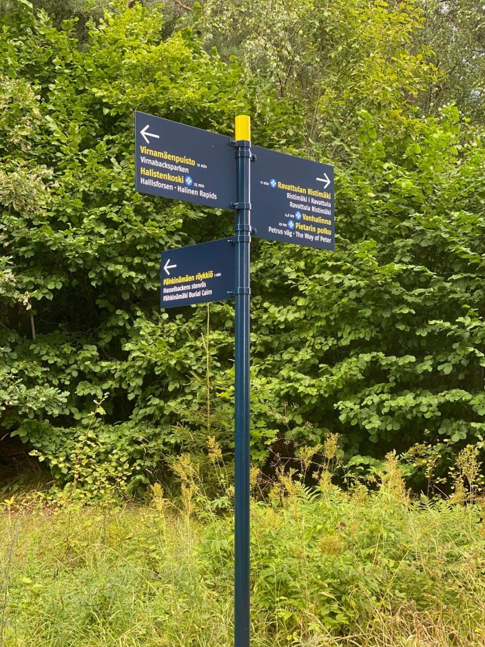
The signs have been implemented in three languages and with clear icons so that they serve a wide range of user groups. They have been placed along key routes and at important junctions where they best support movement and help people find services. At Halistenkoski, for example, the guidance focuses on nature, routes and special destinations in the area.
Making the city’s stories visible
According to Project Manager Riikka Niemelä, who is responsible for developing wayfinding, the aim has been to create a consistent wayfinding approach and visual identity for Turku.
– The aim of urban wayfinding has been to build a clear overall system that helps people understand their surroundings and makes the city’s stories visible. The signs do not only provide information; they also highlight what is essential in the city, Niemelä says.
– At the same time, they support smooth movement and improve the accessibility of services for both residents and visitors.
According to Niemelä, the wayfinding system is based on long-term development work spanning more than ten years, and the same concept is widely used across the city.
The signs encourage people to explore Turku more widely
Project Manager Heini Viljanen from the City of Turku’s Commercial Services emphasises the importance of riverside wayfinding as part of broader urban development.
– The riverside wayfinding system has been a key part of the city centre development spearhead project and the strengthening of maritime Turku. Clear and attractive wayfinding encourages people to move around the city more widely, guides them to new destinations and increases the time they spend in the area, Viljanen says.
– This supports the city’s vitality, as a clear urban environment and good accessibility also create better conditions for businesses operating in the area.
See Images of the New Signs
-
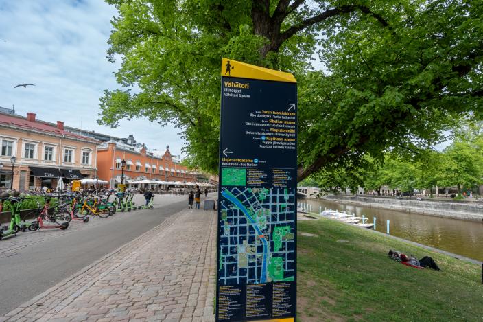
A sign about Vähätori, featuring a map and text. On the left is Vähätori. On the right are the Aura River, summery grass, and trees., Open image in gallery
-
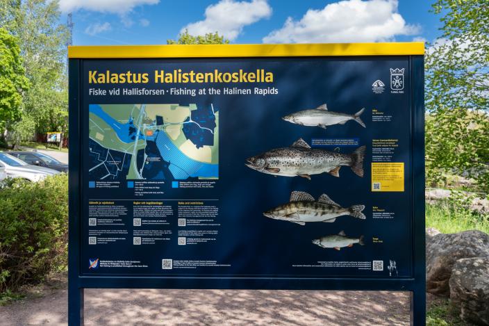
A sign about fishing at Halistenkoski, featuring a map, text, and images of fish. In the background there is summery grass and trees., Open image in gallery
-
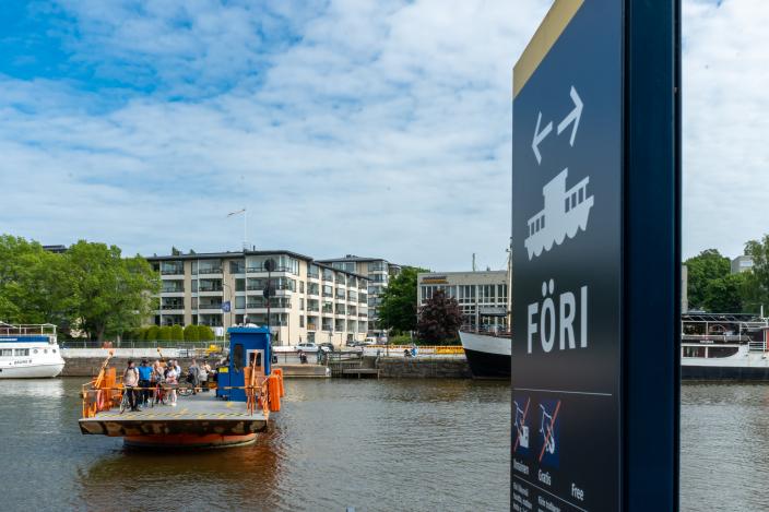
The Föri ferry carrying passengers. In the foreground, a black Föri sign is visible. In the background, there is a shoreline with buildings and trees., Open image in gallery
-
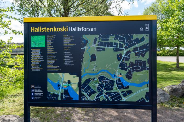
An information sign about Halistenkoski, featuring a map and text. In the background there is summery grass and trees., Open image in gallery
-
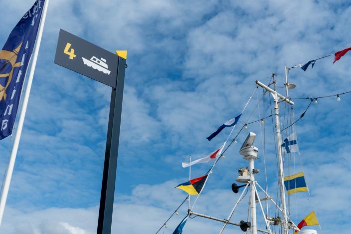
A black sign featuring an image of the Föri ferry and the number four. On the right side, there is a mast with flags attached. In the background, there is a blue sky with clouds., Open image in gallery
-
Three wayfinding signs. In the background, there are trees and vegetation., Open image in gallery